

Yes, a custom home build needs a property survey, and on Central Vancouver Island how hard a requirement it is depends on which authority issues your building permit. Inside Nanaimo one rule applies, in the Regional District of Nanaimo another, and on Salt Spring another again. The stakes are the same everywhere. If a building ends up across a boundary, British Columbia law hands the outcome to a court, and the owner does not choose which outcome arrives. Retiring that risk before the design is locked is a large part of what separates a planned build from a hopeful one, and on design-build custom homes it is one of the first things we settle. Below: which documents you need, when each is due, who asks for them, and what going without actually costs.
What A Property Survey Actually Is (And What It Is Not)
Most people use one word for several different documents. That is the root of nearly every survey argument on a build site: the owner thinks they already have a survey, the designer needs a different one, and the building inspector wants a third.
The Difference Between The Plan On File And The Line On Your Dirt
Your parcel has a record in the land title system. It holds the legal description, the nine-digit parcel identifier, everything registered against the title, and a plan showing the boundaries, the dimensions, and where monuments were set when the land was surveyed. What it does not do is put the line on your ground.
That is fieldwork, and it is a separate job. A property survey is a licensed surveyor going to the lot, finding or re-establishing those monuments physically, and marking where the boundary runs. The plan tells you the boundary exists and what shape it is. The survey tells you where to stand.
Why You Cannot Establish The Boundary Yourself
In British Columbia, determining, locating, defining, or re-establishing a boundary is restricted practice. It is reserved to a practising BC Land Surveyor, and doing it without that standing is an offence. A tape measure, a good eye, and the plan from the title record are not enough, however carefully you work.
This is not gatekeeping for its own sake. A surveyor’s document has value because it holds when someone disputes it: a neighbour, a building official, a lender, or a buyer five years from now. Your own measurement holds only until someone else measures.
Why The Fence, The Hedge, And The Old Stake Are Not Proof Of The Boundary
Occupation lines and legal lines drift apart over decades, and nobody has to do anything wrong for it to happen. A fence gets rebuilt a foot inside the old post line. Each small move sets the reference for the next, and thirty years later everyone agrees on a line that was never the line.
On older Island parcels, rural acreages, and lots subdivided off a larger holding, the original survey pins are often gone, buried, or pushed out of position. Re-establishing the corners from the surrounding survey fabric is the part of the job that takes real time.
The Four Documents Behind A Custom Build, In Order

Survey work on a custom home is a sequence, not a document. Each piece lands at a different moment for a different audience: title and charges, then boundary, then topographic, then the siting certificate during construction. Those four typically arrive as two or three separate engagements, quoted and billed separately, rather than one invoice at the start.
Step 1, The Title Search And Charge Review
Paperwork rather than fieldwork, and by far the cheapest step. Someone pulls your title using the nine-digit parcel identifier and reads what is registered against it: easements, statutory rights of way, restrictive covenants, and building schemes.
This is where a surprising share of the nasty surprises live. A servicing right of way through the only flat bench on the lot. A covenant capping height or requiring a geotechnical report before anyone will look at a permit. A building scheme from a 1970s subdivision that still binds.
The cost of looking is small. A title search runs about $11, and pulling an imaged plan or instrument about $18. The cheapest step in the whole process is the one people skip, and it is the one that surfaces the constraints that reshape a design.
Step 2, The Boundary Survey
Here the surveyor recovers or re-establishes the monuments and marks your corners. You get a drawing of the parcel as it legally exists, and physical points on the ground that a designer and an excavator can work from.
This has to happen before the designer commits to a footprint, for a simple reason. Every setback, every buildable-area calculation, and every siting decision measures from the boundary. If the boundary is assumed, everything measured from it is assumed too, and the error stays invisible until something is poured.
Step 3, The Topographic Survey Your Designer Actually Needs
A topographic survey captures the lot as it physically is: contours and existing grade, rock outcrop, significant trees, wells, septic fields and their reserve areas, driveways, watercourses, and top of bank. It is the drawing that sets the house on the lot, fixes finished floor elevations, and lets drainage be designed rather than guessed at. On the sloped and rocky lots common around Nanaimo and Cumberland, this input drives the entire design rather than documenting it.
It is also the base drawing an engineer works from, which matters if you are weighing whether you need a geotechnical report on a sloped or rocky lot. Ordering the two out of order usually means paying for a second mobilization.
Step 4, The Siting Or Building Location Certificate
Once the forms are set or the structure is up, the surveyor returns and certifies where the building actually sits relative to the property lines and the height limit. This is the document a building department wants before it will release the next inspection, and the one lenders ask for near the end.
Be precise about what it is. A siting or building location certificate is not a registered legal plan. It certifies where your building sat on the day it was measured, for the purpose it was ordered for. That is exactly why lenders and building departments ask for a current one instead of an old one, and it leads straight into the question every client asks next.
Why The Seller’s Old Survey Usually Cannot Be Reused
A certificate is a snapshot tied to a date and a purpose, so its useful life is shorter than people expect. Site conditions change: a deck goes on, a shed appears, a fence is replaced. The document was also scoped for whatever question its original buyer was asking, which may have had nothing to do with building a new house.
Here is a workable rule. An old survey has real value as background, because it shows what the survey fabric looked like and where monuments were once found. Your surveyor will want to see it, and it may shorten the fieldwork. What it does not do is prove anything to a building department today. Use it to inform the work, not to replace it.
Buildable Area Is Not Lot Area
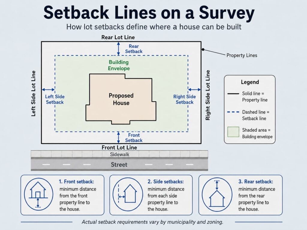
Clients buy lots on gross area. Builders design on net buildable area. The survey is the document that converts one into the other, and the gap between the two numbers is usually much larger than anyone expects.
What Gets Subtracted Before You Have A Footprint
Start with a half-acre, roughly 21,780 square feet. Setbacks come off all four sides. A statutory right of way for servicing takes a strip, an easement for a shared driveway takes another, and a registered covenant area may be untouchable entirely. A riparian buffer along a creek takes a wide band, and steep ground at the back may be unbuildable in practice even where legally available.
Then come the constraints that are not lines on a plan but behave like them. A septic field needs its area plus a reserve area, both sited where the soil allows. A driveway needs a grade a vehicle and a fire truck can climb. What is left is your buildable area: on a constrained lot, a fraction of the advertised number in a different shape than the owner pictured. That is why choosing the right lot in Nanaimo is a design decision as much as a real estate one.
The Invisible Boundary: Watercourses, Ravines, And The Sea
Thirty metres. That is the width of the riparian assessment area on each side of a stream, measured from the stream boundary, and where a ravine is under 60 m wide it reaches 30 m beyond the top of bank. Those distances apply on plenty of Island lots where the watercourse is a seasonal trickle.
Inside that assessment area sits a streamside protection and enhancement area. It is assessed by a qualified professional rather than measured off a plan. A development that falls inside it does not proceed as drawn. Waterfront and bluff lots follow the same logic against the natural boundary of the sea or the edge of a cliff, which is why setbacks near water on Vancouver Island are the constraint most likely to move a house rather than shrink it.
Height Is A Siting Constraint Too
Height is not measured from wherever the finished floor lands. It is measured from a defined grade datum, and how that datum is established is set by the bylaw, not by the builder’s judgement. On flat ground this is uneventful. On a sloped lot the datum can shift by a metre depending on how it is derived, and that metre is the difference between a compliant roof and a non-compliant one.
Getting the datum wrong is as expensive as getting a setback wrong, and often worse, because of when it surfaces. A setback error can show up at excavation. A height error shows up when the framing is done and the roof is on, which is the point at which every fix is a large one.
Setbacks Can Bite On The Projection, Not Just The Foundation
The Regional District of Nanaimo asks for the proposed structure’s distance to each property line to be measured from the eaves. The City of Nanaimo’s plan requirements call for site plans showing setbacks with decks and cantilevers drawn in. Two authorities, one message: the line an inspector cares about is often not the foundation wall.
The list of things that can cross a boundary is longer than owners assume: eaves, gutters, cantilevered upper floors, decks, exterior stairs, retaining walls, septic components, and driveways. Any of them can put you offside while the concrete sits perfectly inside the line, and all of them are easy to design out if the setback lines are on the drawing before the elevations are settled.
Building Inside The City Of Nanaimo
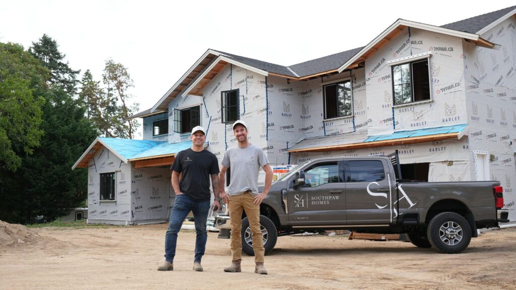
In-City, a surveyor-prepared plan is part of the job on a new home. The useful question is not whether you need one, but how tight your design runs to the limits and what that tightness triggers on top of it.
Nanaimo Requires A Surveyor-Prepared Site And Height Plan
The City of Nanaimo’s residential site and height guidelines call for a site and height plan prepared by a British Columbia Land Surveyor for all new freestanding structures on a residential lot that require a building permit. That belongs in the permit budget rather than in a contingency. The same guidelines add a second trigger: a surveyor-prepared plan is called for where the lot is steep or has an unusual configuration and, in the opinion of the Building Official, it is necessary to confirm the required setbacks and height restrictions can be met. They also let a Building Official waive the plan in whole or in part where a permit is for repair or alteration of an existing building.
In practice the survey goes on the schedule from day one, alongside everything else Nanaimo asks for at permit stage. An application assembled without it is an application that waits.
When Nanaimo Requires A New Surveyor’s Certificate On Setbacks
On top of that, the City sets a tolerance trigger. Where front, rear, or side-yard setbacks come within 150 mm (6″) of the minimum permitted by the Zoning Bylaw, a new survey by a BC Land Surveyor is triggered. If your design pushes toward a setback line, that is the number to know before you commit.
There is a separate 1′ height trigger in Nanaimo, and it is worth stating clearly because plenty of our clients are building a shop or studio alongside the house: the trigger comes from the City’s accessory building requirements and applies to shops, garages, carriage houses, and detached studios, not to the principal dwelling.
One more budget point. The City’s plan requirements treat a sealed site survey, confirming the structure’s proximity to the setbacks, and a height survey, establishing the maximum heights, as two typical requirements rather than one.
What The Survey Has To Show, And The Second Survey At Roof Cap
The City’s plan requirements set out what the plan carries: parcel dimensions, the setbacks and locations of all existing and proposed buildings with decks and cantilevers shown, and the location and dimensions of the driveway along with any rights of way or easements. Where surveyor and designer share a base drawing this falls out of the process; where they do not, it becomes a revision cycle.
Then comes the schedule risk. Where a site and height survey by a BC Land Surveyor was required at building permit application, a follow-up survey is required once the roof cap has been installed and prior to frame inspection, to confirm compliance with setback, height, and other zoning requirements.
A problem found at roof cap stops framing inspection, and every trade booked behind framing stops with it. On a summer build, weeks lost there is a season lost at the far end.
Building Outside The City, In The Regional District Of Nanaimo
Both jurisdictions require a surveyor on a new home. Outside City limits the requirement attaches to the build itself rather than to how close you run to the limits, and it gates a named inspection. That covers a large share of rural and acreage work on this coast, and it covers Gabriola.
A Land Survey Certificate Is Required Before Drainage Inspection
The Regional District of Nanaimo requires a BC Land Survey Certificate for all new construction within a residential zone, prior to drainage inspection. The trigger is new construction in a residential zone, and the gate is the drainage inspection.
The RDN applies a second trigger on top of that, and this is the height rule that matters for a principal dwelling out here: a survey certificate is required where proposed construction is within 1 foot of the allowable height. On a sloped rural lot with a view to protect, that is a close margin, and it is worth knowing which side of it your design sits on before the roof is framed.
What This Means For Your Schedule
Drainage inspection sits early, well before the milestones most owners are watching. A certificate ordered when the inspector asks for it is a certificate ordered too late, and the result is a stop.
Surveyors on this Island book out through the building season, so the delay is often the queue rather than the work. Have the certificate arranged before you need it. We put it on the schedule as a dated item beside the inspection it gates.
Which Rule Applies To Your Lot
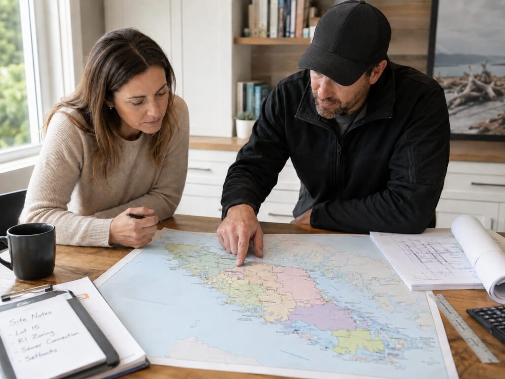
Three regional authorities set the rule on this coast, and there is a fourth answer for everywhere else on the Island. Which one applies to you is decided by where the lot sits, not by what kind of house you are building. Find your row, then read across.
| Where your lot sits | Is a surveyor’s certificate required | When it is due | What triggers it |
| City of Nanaimo | Yes. A site and height plan prepared by a BC Land Surveyor is called for on new freestanding structures on a residential lot | At building permit application, and again once the roof cap is on, before frame inspection | The new build itself, with a further trigger within 150 mm (6″) of a minimum setback |
| Regional District of Nanaimo, including Gabriola Island | Yes. A BC Land Survey Certificate for all new construction in a residential zone | Before drainage inspection | New construction in a residential zone, with a further trigger within 1 foot of allowable height |
| Capital Regional District, including Salt Spring Island | Not by a blanket rule. Expect to provide one, with scope set at application | At application, before design is locked | Set case by case rather than by a published blanket rule |
| Elsewhere on the Island: Courtenay, Comox, Parksville, Qualicum Beach, Ladysmith, Duncan, Cumberland | Set by each local building bylaw | Confirm before design is locked | Your local bylaw. Nanaimo’s 150 mm trigger does not carry over |
Every municipality on the Island sets its own trigger for when a surveyor has to sign off, so the rule in Nanaimo is not automatically the rule in Courtenay, Ladysmith, or Duncan. We confirm the local trigger with your building department before the design is locked. On the islands there is a second body to satisfy as well.
Gabriola Island: RDN For The Permit, Islands Trust For The Zoning
Gabriola sits in the Regional District of Nanaimo as Electoral Area B, so your building permit and your inspections come from the RDN. The RDN rule applies in full: a BC Land Survey Certificate for all new construction in a residential zone, before the drainage inspection.
Zoning and siting are a different desk. Those come from the Islands Trust, whose bylaws regulate use, density, siting, and size. Two bodies, two approvals, and survey work that has to satisfy both. Getting the certificate right for the RDN does not answer a siting question the Trust asks.
Salt Spring Island: The Capital Regional District, Not A Nanaimo Authority
On Salt Spring your building permit comes from the Capital Regional District. Its building inspection service covers the electoral areas of Juan de Fuca, Salt Spring Island, and the Southern Gulf Islands, with a Salt Spring office on Fulford-Ganges Road. Zoning and siting come from the Islands Trust, under Salt Spring’s Land Use Bylaw No. 355.
The two islands do not run the same way: on Gabriola the certificate is a blanket requirement tied to a named inspection, while the Capital Regional District does not publish that same trigger, so on Salt Spring the survey scope is set with the building inspector at application.
Waterfront and bluff detail often shapes the house: island applications ask for setbacks to lot lines, to the natural boundaries of watercourses and the sea, and where applicable to the edge of a cliff. None of those three lines is where an owner would guess.
What Actually Happens If The House Crosses The Line
An encroachment is not a paperwork problem that gets tidied up at closing. It is a legal exposure with a small number of possible endings, and the owner is not the one who picks among them.
Three Outcomes, And The Owner Does Not Pick
Under British Columbia’s Property Law Act, where a survey finds that a building encroaches on adjoining land, or that a fence has been improperly located so as to enclose adjoining land, the Supreme Court may do one of three things. It may declare an easement over the affected land, for a period and on the compensation the court determines. It may vest title to the land encroached on in the encroaching owner, again on compensation the court determines. Or it may order the owner to remove the encroachment so that it no longer encroaches.
Three outcomes, all expensive. Removal is a live outcome, and a court weighing it is not weighing your build schedule. The provision engages when a survey finds the encroachment: the survey either prevents the problem or discovers it, and only one of those is cheap.
Can You Just Work It Out With The Neighbour
Not durably, and this is where people get caught by a rule they half remember. BC law does give a limited right to enter adjoining land temporarily to make repairs. That is a right to go over and fix something, not a right to leave part of your building there.
An informal agreement has a second problem. It does not survive a sale, a subdivision, or a new owner with different plans, because it is a personal understanding rather than an interest in land. That is why a real resolution has to be registered against title rather than agreed over the fence.
The Property Line Is A Building Code Constraint, Not Just A Zoning Line
Here is the point most owners have never heard. How close a wall may sit to a property line, and how much window you are allowed in that wall, are set by the current BC Building Code through limiting distance. That is a fire-safety calculation, and it is not the same limit as your zoning setback.
The two constraints interact. A wall can satisfy the setback and still fail on glazing, because the code measures the exposing face against the property line and works out how much unprotected opening it will allow. Get the line wrong and you have not simply breached a setback: you have invalidated the window schedule, and the redesign reaches into the elevations and often into the view the house was designed around.
What A Survey Costs, And Where It Sits In The Budget

Cost is usually the first question a client asks, and the answer has two parts: why nobody can hand you a rate, and why the number matters less than it feels like it should.
Why You Get A Quote Instead Of A Rate
Survey fees are set by each firm and are not published as a schedule. They depend on how much work the lot demands: parcel size, terrain, access, vegetation, and above all how much of the original survey evidence is still in the ground. That is why you get a quote rather than a rate, and why two quotes for neighbouring lots can be far apart without either being unreasonable.
You can read your own lot before you call. Expect heavier work on rural acreage, in heavy vegetation, on steep or rocky ground, in old subdivisions where monuments are likely missing, and on waterfront where natural boundaries have to be located. Expect lighter work on a flat, cleared urban lot with recoverable pins. And budget for a sequence: this is usually two or three engagements across the build, not one.
The Cost Asymmetry
The survey is a small line item on a build budget. What it protects against is not a line item at all, which is the whole point. A foundation in the wrong place is a demolition, a redesign, a re-permit, a lost building season, and possibly a court deciding the outcome instead of you. Those are different kinds of cost, not different sizes of the same one.
Go back to the title search: about $11 to pull the document that reveals the right of way through your building envelope, the covenant capping your height, or the easement nobody mentioned at closing. The cheapest document in the whole process is the one that surfaces most of the expensive surprises. Survey work is a known, quotable, schedulable expense you control. The alternative is an unknown one that someone else controls.
What A Cheaper Version Gives Up
Scoping a survey down is a legitimate choice and sometimes the right one. Boundary only with no topographic. Corners marked with no certificate. Both save real money, and what they do is move specific risks off the invoice and onto the design.
Skip the topographic work and you lose designed drainage, reliable finished floor elevations, and an accurate read on excavation and rock, so those become assumptions the excavator prices as contingency. Skip the siting certificate and you lose the mid-build check that catches a small error while it is still small. On a large flat lot where the house sits well inside its envelope, a leaner scope is defensible. On a tight, sloped, or waterfront lot, the saving is borrowed against the riskiest part of the project.
Where A Property Survey Lands In A Custom Home Build

A survey ordered late confirms a problem instead of preventing one. Sequencing is what turns this line item from a compliance cost into a design tool, and it is one of the easiest things to get right.
The Survey Lands Before The Design Is Locked
The order we work in is straightforward. Title and charges as soon as a lot is under consideration, ideally before it is bought. Boundary and topographic survey right after closing, before concept design begins. Geotechnical work next, using the topographic drawing as its base. Then design against a real envelope, then permit application, then construction with the siting certificate scheduled against the inspection that requires it.
The failure mode is ordering the survey to satisfy the permit rather than to inform the design. That produces a house that is technically legal and badly placed: the view partly blocked, the driveway steeper than it needed to be, the best of the lot under a septic field that could have gone elsewhere. Nothing in that build breaches a rule. It is simply not the house the lot could have carried.
What To Ask Before You Hire A Surveyor
A short list tells you more than a price comparison. Which products are in this quote: boundary, topographic, or both. Is monument recovery included, or billed as extra if the pins are not found. What format is the deliverable in, and can our designer and geotechnical engineer work from it directly.
Then the two questions people forget. What is your turnaround right now, in season, from instruction to drawing. And is the return visit for the siting certificate priced in now, or quoted later when we need it on short notice.
How We Retire Site Risk Before The Price Is Set
Underneath every survey conversation is a different question: does this builder plan, or does this builder react. A fixed-price contract is only honest if the site risk was retired before the price was set, which is why we want title, boundary, and topographic information in hand before we quote rather than after. As a BC Housing Licensed Residential Builder working across Nanaimo, the RDN, and the islands, our team knows which lots hide their constraints and which announce them.
If you are weighing a lot or moving into design, this groundwork is where we start as a custom home builder Nanaimo families rely on. Southpaw Homes is glad to look at your parcel with you, so talk to us before your design is locked and we will tell you what the lot will ask for.
Frequently Asked Questions
Do I Need A Property Survey To Build A Custom Home In BC?
Yes, on a new home you should plan for one, and the exact requirement is set by whoever issues your building permit. Inside Nanaimo, a site and height plan prepared by a BC Land Surveyor is called for on new freestanding structures on a residential lot. In the Regional District of Nanaimo, including Gabriola, a BC Land Survey Certificate is required for all new construction in a residential zone before drainage inspection. Elsewhere, confirm the local trigger with your building department before the design is locked.
Can I Use The Survey The Previous Owner Gave Me?
Usually not as proof of anything. A survey certificate is a snapshot tied to a date and to the question someone else was asking, so it records where things sat then, not where they sit now. Fences get replaced, decks and sheds get added, and the original work may never have covered what you need. It still has real value as background, because it shows the survey fabric your surveyor will work from. Treat it as a starting point, not as evidence for a building department.
What Is The Difference Between A Survey Certificate And A Building Location Certificate?
A building location certificate is not a registered legal plan. It certifies where your building sat on the day it was measured, for the purpose it was ordered for. The registered plan in the land title records is a different animal: it defines the parcel and its boundaries, and it does not change when a deck goes up. That difference is why lenders and building departments ask for a current certificate rather than an old one, and why last decade’s certificate does not answer this year’s question.
How Long Does A Property Survey Take?
It depends on the lot more than on the surveyor. Fieldwork on a clean urban lot with recoverable monuments is quick. On a rural acreage with heavy brush, steep ground, or missing corners, recovery work can run for days before any drafting begins. Then there is turnaround on the drawing itself, and the calendar: Island surveyors book out through the building season, so the wait is often the queue rather than the work. Book as soon as you have the lot.
Who Is Allowed To Determine My Property Boundary?
In British Columbia, only a practising BC Land Surveyor may determine, locate, define, or re-establish a property boundary. That is restricted practice under provincial law, and doing it without that standing is an offence. Your builder, your designer, your neighbour, and a rented measuring wheel cannot give you a boundary that holds when someone disputes it. The reason to hire a surveyor is not paperwork. It is that the resulting document is defensible, and nothing else you can produce is.
Is The Fence On My Property Line?
Almost certainly not exactly. Fences get rebuilt slightly off the old line, hedges creep, driveways get widened, and each small move sets the reference for the next one. Over decades the line people occupy and the line on the registered plan drift apart, and neither neighbour did anything wrong. On older Island parcels the original corner posts may also be buried, pushed, or gone. Assume the fence is roughly right and never that it is exactly right, particularly if you plan to build near it.
What Happens If My House Is Built Over The Property Line?
Under BC’s Property Law Act, a court decides, and it has three options. It can grant an easement over the affected land for a period and on the compensation it determines, vest title to that land in the encroaching owner on compensation it determines, or order the encroachment removed. You do not get to pick the cheapest one, and removal is a real outcome rather than a theoretical one. The provision engages when a survey finds the encroachment, which is the whole argument for surveying early.