
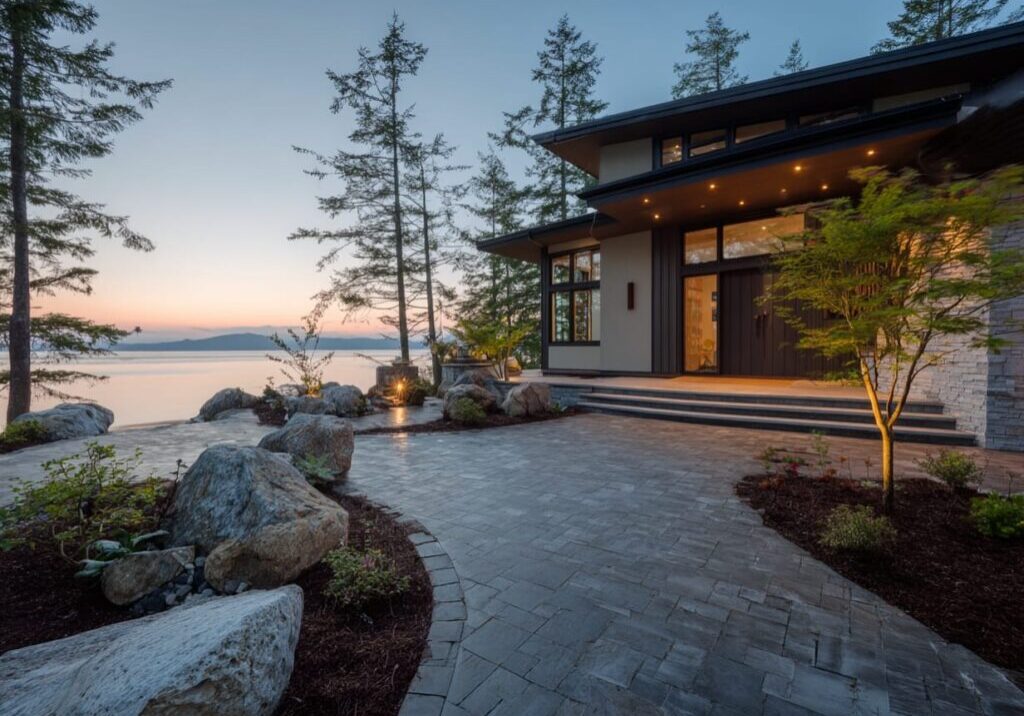
There is no single water setback that applies to every Vancouver Island custom home. A waterfront, creekside, lakeside, wetland-adjacent, or ravine lot may need to satisfy local zoning, environmental development permit areas, BC’s Riparian Areas Protection Regulation, flood construction levels, sea level rise rules, and site-specific professional reports before the buildable area is clear. If you are buying or designing on a constrained lot, talking to a custom home builder in Nanaimo before design begins helps confirm whether the view, creek, or shoreline can sit close to the house.
At A Glance: What To Check Before You Design Near Water
The fast answer is this: “How close can I build to water?” depends on the water feature, the local government, environmental overlays, flood or sea level rise exposure, slope stability, and whether the project disturbs land inside a protected or assessed area. A large waterfront lot can still have a small buildable envelope once setbacks, access, servicing, drainage, and hazard areas are mapped.
Before you draw the house, confirm the exact water feature: ocean, lake, wetland, stream, creek, ditch, pond, ravine, or drainage corridor. Then check zoning, watercourse schedules, floodplain maps, sea level rise maps, development permit areas, and any local environmental protection rules.
Expect deeper review if your proposed house, driveway, garage, deck, retaining wall, service trench, or land alteration is inside a sensitive area. On many sites, you may need a QEP, surveyor, geotechnical engineer, coastal engineer, or development permit before the final buildable area is confirmed.
What Counts As “Near Water” On Vancouver Island?

A water setback is the minimum distance a building, structure, driveway, service trench, or land alteration must stay back from a water feature or natural boundary. Depending on the local rule, the measurement may start from top of bank, natural boundary, wetland boundary, stream boundary, or another mapped or field-confirmed reference point.
That means “near water” is broader than many buyers expect. A property does not need to be oceanfront to be constrained by water-related rules.
It Is Not Just Oceanfront Property
“Near water” can include marine shoreline, but it can also include a creek, stream, ravine, wetland, lake, pond, ditch, drainage channel, estuary, or marine foreshore. Even a small or seasonal-looking feature can affect the buildable envelope if it meets the local or provincial definition that applies to your site.
On Vancouver Island, regional districts and municipalities often define a “watercourse” broadly, including streams, ditches, wetlands, lakes, ponds, and the sea, and they apply a 30 metre review distance whether or not the water is dramatic on the surface.
For a custom home buyer, the lesson is simple. Do not judge a lot only by what looks like “real water” during a summer site visit. Confirm how the local government classifies the feature and what that classification does to the building envelope.
The Feature May Be Mapped, But It Still Needs Field Confirmation
Municipal and regional maps are the starting point, not the full answer. A map may show a watercourse, marine foreshore area, development permit area, or flood risk area, but the exact setback may still need a site survey, QEP review, top-of-bank confirmation, natural boundary confirmation, wetland boundary confirmation, or other professional interpretation.
This matters most when every metre counts. On a tight lot, a small shift in the confirmed top of bank or wetland edge can affect the home footprint, driveway location, garage, deck, or septic and utility routing.
Listing photos, old surveys, and visible water are not enough. A dry ditch, a treed ravine, or a wetland edge can still shape what can be designed and permitted.
Seasonal Water And Drainage Features Can Still Affect Design
Some water features do not look dramatic year-round. A ditch may be dry in August. A creek may be hidden in vegetation. A low area may only show its wetland character after winter rain. Those features can still influence environmental review, stormwater design, erosion control, and setbacks.
The design risk is not only whether the house fits. It is whether the whole site plan works: access, service routes, drainage, retaining, outdoor space, and construction staging.
When in doubt, verify early. It is much cheaper to move a concept house on paper than to redesign after permit review, survey, or environmental assessment.
The Main Rule Layers: Local Setbacks, RAPR, And Hazard Areas
Water-adjacent lots can be affected by several rule layers at once. Local zoning and development permit areas may set one layer. BC’s Riparian Areas Protection Regulation may add another. Flood, sea level rise, ravine, slope, or erosion hazards can add more.
The practical job is to identify which layer controls your project. On some lots, the environmental setback is the main issue. On others, sea level rise, slope stability, or stormwater routing may be the real limiter.
Local Zoning And Development Permit Areas Come First
Local governments set zoning rules, development permit area guidelines, watercourse schedules, and permit triggers. That means Nanaimo, Parksville, Courtenay, Comox Valley Regional District, Regional District of Nanaimo, Cowichan Valley, Strathcona, and Islands Trust areas can all handle water-adjacent development differently.
In Nanaimo, the City’s zoning bylaw and mapping resources confirm baseline land-use rules, including yard setbacks, lot coverage, and Schedule C for watercourses and marine foreshore. That local layer should be checked before you assume a provincial rule is the only issue.
This is why online advice can only go so far. The correct first question is not “What is the Vancouver Island setback?” It is “Which local government has authority over this property, and what maps, bylaws, and DPAs apply?”
RAPR Adds A Provincial Riparian Review Layer
BC’s Riparian Areas Protection Regulation applies to certain residential, commercial, and industrial developments proposed in riparian assessment areas of streams that provide fish habitat to protected fish. It calls on local governments to protect riparian areas during development by ensuring that a Qualified Environmental Professional conducts a science-based assessment of proposed activities.
RAPR does not always mean “you cannot build.” It means the proposed location, disturbance area, construction methods, protection measures, and approval path may need to be reviewed and documented by the right professional.
For homeowners, the key is timing. If RAPR might apply, treat it as a feasibility question before design gets too detailed.
Flood, Sea Level Rise, And Slope Hazards Can Add More Limits
Environmental setbacks are not the only concern near water. Coastal lots may also be affected by flood construction levels, sea level rise, wave action, coastal erosion, bluff instability, or ravine slope hazards.
The 2018 amendment to BC’s Flood Hazard Area Land Use Management Guidelines incorporated sea level rise into building setbacks and flood construction levels in coastal areas. Nanaimo’s DPA3 Sea Level Rise guidelines also require a development permit for proposed development within DPA3 and call for a qualified professional report that identifies setbacks, elevations, and other conditions to protect development from sea level rise.
On a shoreline lot, the question is not only “how far back?” It may also be “how high?”, “what professional report is required?”, and “what coastal hazard conditions apply?”
The 30 Metre Question: What It Means And What It Does Not Mean
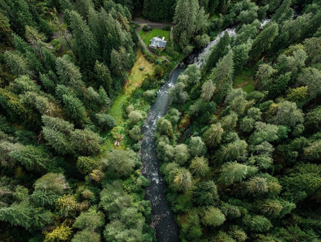
Thirty metres comes up often in conversations about building near water in BC. It is an important number, but it is often misunderstood.
On many projects, 30 metres is a review or assessment trigger. It is not always the final building setback, and it is not the only rule that can apply.
The 30 Metre Riparian Assessment Area
Under BC’s Riparian Areas Protection Regulation, the riparian assessment area for a stream generally consists of a 30 m strip on each side of the stream, measured from the stream boundary. If the stream is in a ravine, the regulation adds specific ravine measurement rules beyond the top of ravine bank, depending on ravine width.
The practical takeaway: 30 metres is often the area where the proposed development must be assessed. It is not a universal “every house must be exactly 30 metres away” rule in all circumstances.
Still, if any part of your house, deck, driveway, service trench, clearing, or grading falls within that zone, assume you need to ask better questions before you design.
SPEA Is The Area That Needs Protection
SPEA stands for Streamside Protection and Enhancement Area. It is the protected riparian area identified through assessment to preserve the natural features and functions that support fish habitat.
RAPR says the SPEA is the portion of the riparian assessment area that includes land capable of supporting streamside vegetation and links aquatic and terrestrial ecosystems. The regulation also ties development approval to assessment reports and recommended measures when RAPR applies.
For a homeowner, the SPEA matters because it may define where development should not occur, what restoration or mitigation measures are needed, and how the buildable envelope should be adjusted.
Why 30 Metres Still Matters Even If You Hope To Build Closer
Even when a site-specific assessment or local development permit process may allow some form of development near water, the 30 m area remains a major feasibility flag. It can affect cost, schedule, reports, design flexibility, construction fencing, erosion control, and long-term maintenance.
It can also apply to more than the main home. A garage, deck, driveway, retaining wall, drainage trench, utility route, or septic-related work can all matter depending on the jurisdiction and site.
So do not treat 30 metres as a simple yes-or-no answer. Treat it as the point where professional review and careful site planning often begin.
How Setbacks Are Measured
Setbacks near water are only useful if you know where the measurement starts. This is where many lot buyers get tripped up.
A water setback is not usually measured from where you happen to see water that day. It may be measured from top of bank, natural boundary, wetland boundary, stream boundary, or another technical point set by the rule that applies.
Ocean And Marine Foreshore
For marine shorelines, setback areas are measured from the natural boundary of the ocean, and Nanaimo’s watercourse protection overview sets 15 m setbacks for lakes, wetlands, and marine foreshore areas, while noting that exact distances vary by watercourse size, riparian condition, and connectivity.
On a coastal lot, the natural boundary is only one part of the question. Sea level rise, flood construction levels, wave and wind effects, erosion, and geotechnical conditions may also affect the practical building location.
That is why shoreline design should not begin with a view sketch alone. It should begin with maps, survey, hazard review, and early siting work.
Rivers, Creeks, Streams, And Ravines
For rivers, creeks, and streams, setbacks are typically measured from the top of bank, and example distances vary based on the type and condition of the watercourse. Nanaimo’s published examples include 30 m for rivers and streams with significant riparian areas, 15 m for most streams and creeks, and 7.5 m for minor isolated or indirectly connected streams.
Ravines add another layer. Under RAPR, ravine-related riparian assessment areas can be measured from the stream boundary to points beyond the top of ravine bank, depending on whether the ravine is less than or at least 60 m wide.
This is why “the creek is far away” is not enough. The bank, ravine, slope, and mapped protection area may be the real design limits.
Lakes, Ponds, And Wetlands
For lakes and ponds, Nanaimo measures setback areas from the wetland boundary rather than a visible water edge.
Wetland boundaries can be difficult to identify without field review. What looks like a damp area or seasonal low spot may need professional interpretation if it affects development.
If the buildable envelope is tight, get the measurement confirmed before design. A few metres can change the location of the house, garage, driveway, or outdoor living space.
Nanaimo Example: Why The Setback Number Can Change
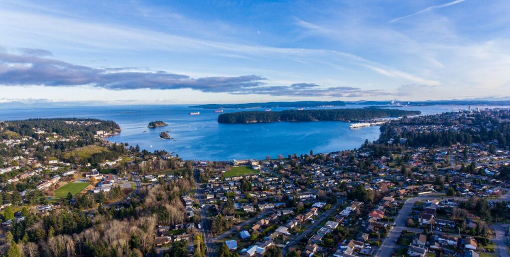
Nanaimo is a useful example because its public watercourse protection guidance shows that different water features can have different setbacks. That does not mean the same numbers apply everywhere on Vancouver Island, but it does show why you should not guess.
The same property may also be affected by more than one development permit area. A waterfront lot can involve watercourse protection, sea level rise, flood construction level, slope, and servicing questions at the same time.
Nanaimo Uses Different Setbacks For Different Watercourses
Nanaimo’s watercourse setbacks vary depending on factors such as watercourse size, riparian condition, and connectivity. The same property may be subject to different distances depending on which feature you measure from.
That range is exactly why a buyer should avoid shorthand advice like “it’s probably 15 metres” or “it’s always 30 metres.” The correct distance depends on what the feature is and how the City classifies it.
When the site is constrained, ask the City or your project professionals to confirm the applicable measurement point and setback before you design around a number.
DPA1 Can Affect What Happens Inside The Setback
Nanaimo’s Official Community Plan designates watercourses, lakes, ponds, and their setbacks as Development Permit Area One (DPA1). Structures may still be built within a setback area if a Development Permit is obtained, allowing activities in the setback to be managed and habitat compensation to be addressed.
That does not mean building in a setback is easy or guaranteed. It means there may be a process, and that process needs the right design, reports, and mitigation measures.
The role of development permits for custom homes in Nanaimo extends well beyond water-adjacent sites. They shape timing, sequencing, and which professional reports become mandatory before construction can start.
DPA3 Sea Level Rise Can Affect Shoreline Lots
Shoreline lots can be affected by DPA3 Sea Level Rise in addition to watercourse or marine foreshore setbacks. Nanaimo’s DPA3 guidelines require a development permit before proposed development within DPA3, and they require a qualified professional report that models wave and wind effects, identifies setbacks and elevations, and calculates the required flood construction level for the property.
For homeowners, this changes the design question. The home may need to be pulled back, raised, or engineered around coastal hazard conditions.
A view lot can still be a great opportunity, but it needs a buildable-area strategy before the floor plan is locked.
Vancouver Island Examples Beyond Nanaimo
Vancouver Island includes multiple municipalities, regional districts, and Islands Trust jurisdictions. Rules, application forms, mapping layers, and professional report requirements vary.
The safest approach is to confirm the authority having jurisdiction before you apply Nanaimo-specific assumptions to another area.
Comox Valley Regional District Freshwater Or Coastal Development Permits
The Comox Valley Regional District’s Freshwater or Coastal Development Permit process is triggered if proposed development or land alteration is within 30 metres of a watercourse, including a stream, ditch, wetland, lake, pond, or the sea. Required application materials include a site plan, land title, biophysical assessment, rainwater management plan, and a RAPR assessment report if triggered.
This matters if you are considering a lot near Courtenay, Comox, Cumberland, Royston, Union Bay, or rural CVRD areas. Local review may look different from Nanaimo even when the same general environmental principles apply.
If your search spans several communities, build a jurisdiction check into your lot-screening process.
Courtenay Environmental Development Permit Example
Courtenay’s DPA-4 Environmental checklist requires a 30 metre setback from the stream boundary on properties subject to RAPR, lists exceptions where a RAPR-determined SPEA may apply, and includes construction-phase requirements such as sediment containment and erosion control measures before development activity.
This example shows why the process can be both local and site-specific. A rule may state a setback, then provide conditions, exceptions, report requirements, or restoration expectations.
The action step is to ask local planning staff what applies to your property and proposal before design assumptions harden.
Why Local Confirmation Beats General Advice
General advice can help you ask the right questions, but it cannot confirm the buildable envelope. A property’s local government, zoning, water feature, mapping layers, professional reports, and title conditions all matter.
That is especially true on Islands Trust islands, regional district lands, and shoreline lots where jurisdiction, foreshore conditions, archaeological considerations, and environmental requirements can be more complex.
Before spending heavily on drawings, confirm the local authority, request pre-application guidance where appropriate, and get the right professionals involved.
Setbacks Are Not Just For The House Footprint
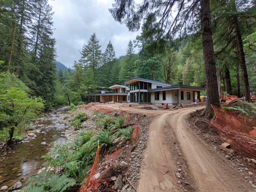
A common mistake is checking only whether the house fits. Near water, the entire site plan matters.
Decks, garages, driveways, retaining walls, septic fields, service trenches, drainage swales, and temporary construction access can all affect the approval path.
Decks, Garages, Driveways, And Retaining Walls Can Count
As a general rule in Nanaimo, no new structures, buildings, additions, driveways, parking lots, fences, and similar features can be built within a watercourse setback area without specific approval.
That means you can technically fit the house and still fail the site plan. A driveway through the protected area, a deck projection, or a retaining wall near the bank may create new review issues.
Design the full site early. The buildable envelope is not just the living room and bedrooms.
Services And Utility Trenches Can Trigger Review
Water, sewer, storm, hydro, drainage, and utility corridors matter because they disturb soil and can affect runoff, vegetation, and protected areas. Under RAPR, “development” includes adding, removing, or altering soil, vegetation, buildings, structures, and certain works and services, which is why site services cannot be treated as an afterthought near water.
This is where early servicing review pays off. A beautiful house location may not work if the service route cuts through the wrong area, creates erosion risk, or requires too much disturbance.
Working through a site servicing checklist before design helps confirm that water, sewer, storm, and routing options actually fit the buildable envelope and not just the floor plan.
Construction Access And Erosion Control Matter Too
Temporary work can still matter near water. Construction access, stockpiles, equipment movement, clearing, sediment control, and protection fencing can affect sensitive areas before the home is even framed.
Construction-phase guidance from Vancouver Island municipalities commonly includes protecting roots and native vegetation, preventing foreign material from entering environmentally sensitive areas, and installing sediment containment and erosion control measures before development activity begins.
A good sensitive-site plan looks beyond permit drawings. It also shows how the build will actually be protected during construction.
When You May Need A QEP, Surveyor, Geotechnical Engineer, Or Coastal Engineer
Water-adjacent sites often need more than one professional input. That is not a sign the lot is impossible. It is how the buildable area, hazard conditions, and environmental protection measures get confirmed.
The earlier those roles are sequenced, the less likely the design will need major revisions later.
Qualified Environmental Professional (QEP)
A Qualified Environmental Professional is typically involved when RAPR, a riparian assessment, SPEA, biophysical assessment, or habitat impact review is triggered. RAPR protects riparian areas by requiring QEP-led science-based assessments of proposed activities during residential, commercial, and industrial development.
The QEP helps define the environmental side of the buildable area. They may identify protected zones, required measures, restoration needs, and limits on disturbance.
If a QEP is needed, bring them in before the site plan is emotionally locked. The home should be designed around confirmed constraints, not redesigned after them.
BC Land Surveyor
A BC Land Surveyor may be needed to confirm property boundaries, natural boundary, top of bank, wetland boundary, setback lines, existing structures, easements, and the proposed building envelope. This is especially important when the home, garage, driveway, or services must fit into a tight area.
A survey helps turn “roughly there” into a designable line. That matters when a few metres can change whether the home fits.
For water-adjacent lots, a survey is often not just a formality. It is the base layer for design, environmental review, and permit coordination.
Geotechnical Or Coastal Engineer
A geotechnical engineer may be needed for ravines, slopes, bluffs, erosion, fill, unstable ground, groundwater, or foundation planning near water. A coastal engineer may be needed for sea level rise, wave action, coastal flood construction levels, shoreline erosion, or marine exposure.
Nanaimo’s DPA3 Sea Level Rise guidelines specifically reference a report by a Qualified Registered Professional with sea level rise experience, such as a Coastal Engineer, to identify setbacks, elevations, and conditions to protect development.
For slope, ravine, groundwater, or foundation uncertainty, a geotechnical review near water can help clarify risk before design goes too far.
Water Setback Feasibility Table
Use this table as a first-pass filter. It is not a substitute for local government review, but it helps you see what kinds of questions tend to come up.
If a property touches more than one category, assume the most restrictive or complex path may control until confirmed.
| Water Feature | First Rule To Check | Typical Report Or Permit | Why It Matters |
| Ocean / Marine Foreshore | Local shoreline setbacks, sea level rise DPA, flood hazard rules | Coastal engineer, geotechnical report, development permit | Controls both distance from shore and required building elevation |
| Creek / Stream / River | RAPR, local watercourse setbacks, top-of-bank measurement | QEP/RAPR assessment, development permit, survey | May shrink the buildable envelope and affect driveways/utilities |
| Ravine | RAPR ravine rules, steep slope DPA, geotechnical stability | QEP, geotechnical engineer, survey | Setback may be measured from top of ravine bank and slope stability may drive design |
| Lake / Pond | Local lake/pond setback, wetland boundary, flood hazard guidance | Survey, environmental report, possibly development permit | Measurement point and flood level can affect house placement |
| Wetland | Wetland boundary, environmental DPA, RAPR if applicable | QEP/biophysical assessment | Boundary can be hard to identify without field review |
| Ditch / Drainage Channel | Local definitions, drainage rules, RAPR trigger if applicable | Local planning review, QEP if triggered | Can still affect development even when it looks minor |
The table should help you decide what to ask next. It should not be used to place a building on its own.
How To Use The Table
Start by identifying every water feature on or near the lot, then match each feature to the first rule layer you need to check. If the lot has a creek and a steep ravine, you may need environmental and geotechnical review. If the lot is oceanfront, you may need marine foreshore, sea level rise, flood construction level, and erosion review.
Next, map the whole site plan: house, garage, driveway, decks, services, drainage, retaining, and construction access. The buildable envelope only works if the whole project fits.
Finally, confirm assumptions with the local government and the right professionals before you move into detailed design.
Waterfront And Watercourse Lot Checklist: 10 Things To Verify Before You Design
Water-adjacent lots are attractive because of privacy, views, access to nature, and long-term lifestyle value. They also deserve more due diligence than a standard subdivision lot.
Use the checklist below before you remove purchase conditions or start permit drawings.
The 10 Checks
- Confirm the local government and zoning.
- Identify every water feature on or near the lot.
- Check local watercourse, marine foreshore, floodplain, and sea level rise maps.
- Confirm how the setback is measured: top of bank, natural boundary, wetland boundary, or stream boundary.
- Ask whether RAPR applies and whether a QEP is needed.
- Ask whether a development permit is required.
- Confirm whether a geotechnical or coastal engineering report is needed.
- Map the buildable envelope with house, garage, decks, driveway, septic/services, and drainage.
- Plan erosion control, construction access, and site protection before clearing.
- Review feasibility with the builder before removing purchase conditions or finalizing design.
This checklist keeps the decision grounded. It does not tell you whether to buy the lot, but it tells you what to verify before the lot’s appeal turns into a design constraint.
What To Check Before Buying A Waterfront Lot

A water-adjacent lot should be evaluated as both a lifestyle purchase and a buildability problem. The view, privacy, shoreline, creek, or forested ravine may be the reason you love the property, but the same feature may also limit house size, driveway placement, garage location, service routing, outdoor living space, or construction access.
Before you buy, ask: Where can the house actually sit? Where can vehicles enter? Where do services run? Where does stormwater go? What reports are likely? Which approvals could affect schedule?
If you are comparing lots, water setback review belongs on the same due diligence list as the broader work of choosing a custom home lot in Nanaimo.
Can You Build Inside A Setback?
Sometimes, but you should never assume it. Some local rules allow limited development, development permit review, variance consideration, restoration measures, or site-specific professional recommendations.
The path depends on the jurisdiction, water feature, existing disturbance, hardship, hazard risk, environmental impact, and proposed mitigation.
Sometimes, But Do Not Assume It
In Nanaimo, structures may be built within a watercourse setback area if a Development Permit is obtained. The permit manages activities in the setback and the compensation needed to maintain no net loss of habitat.
That does not make setback encroachment simple. It makes it a review path with conditions, documentation, and uncertainty.
A better strategy is to first design outside the constrained area where possible. Then consider alternatives only if the property cannot reasonably support the home otherwise.
Existing Homes And Rebuilds Can Be More Complicated
An existing home near water does not automatically guarantee that a new home can be rebuilt in the same location. Renovations, additions, teardowns, and rebuilds can trigger new review if they change the footprint, foundation, disturbance area, services, use, or hazard exposure.
Older approvals may not answer today’s question. The local government may review the current proposal under current maps, DPAs, environmental requirements, and hazard guidance.
If the existing structure is close to water, confirm whether repair, expansion, replacement, or full rebuild changes the approval path before making design promises.
Variances Do Not Override Environmental Or Hazard Reality
A variance may address some zoning setbacks, but it does not erase environmental protection, riparian rules, flood hazard, sea level rise, geotechnical constraints, or provincial requirements.
The CVRD’s public planning information makes this distinction clear: development permits protect natural environments and development from hazardous conditions, while development variance permits vary zoning rules such as setbacks but do not vary use or density.
So “we’ll just get a variance” is not a reliable strategy. First identify which rule is limiting the design, then choose the right approval path.
Design Strategies For Homes Near Water
A constrained water-adjacent lot can still support a beautiful custom home. The best designs respond to the confirmed buildable area rather than fighting it.
That means the house, driveway, services, drainage, views, and outdoor rooms should be planned together.
Pull The Home Back And Protect The View Through Design
A setback does not automatically ruin the waterfront experience. Window placement, upper-level views, covered decks outside protected areas, landscape framing, indoor-outdoor transitions, and careful room orientation can preserve the feeling of connection to water.
Sometimes pulling the home back improves the design. It can create better privacy, reduce hazard exposure, protect vegetation, and give the home a calmer relationship with the site.
The goal is not to place the house as close to water as possible. The goal is to place the house where it is safe, permit-ready, livable, and durable.
Keep Disturbance Low And Concentrated
Sensitive lots reward efficient design. A compact disturbance area, shorter service routes, thoughtful driveway alignment, and limited clearing can help protect the site and simplify review.
This does not mean every home must be small. It means the footprint, access, utilities, outdoor space, and construction route should be intentional.
The fewer unnecessary cuts, fills, trenches, and retaining walls near sensitive areas, the easier the project usually is to explain, price, and build.
Use Drainage, Erosion Control, And Landscaping As Part Of The Design
Stormwater and erosion control are not landscaping afterthoughts near water. They protect the home, neighbouring properties, and the water feature. Rainwater management plans and biophysical assessments are commonly listed among the required materials for Freshwater or Coastal Development Permit applications.
Good drainage planning starts early. It should influence grading, downspouts, hardscape, foundation drainage, swales, planting, erosion control, and service routing.
Common Mistakes To Avoid Near Water
Most mistakes near water happen because the design starts before the site is understood. The lot looks buildable, the view is exciting, and the concept plan moves ahead before setbacks, reports, and access are confirmed.
Avoid these common errors:
- Assuming 15 m or 30 m is the answer without checking the exact jurisdiction.
- Measuring from the wrong line, such as a property line instead of top of bank or natural boundary.
- Forgetting that driveways, decks, retaining walls, fences, and services can count.
- Designing before QEP, survey, or geotechnical input.
- Assuming old structures can always be rebuilt in place.
- Ignoring sea level rise, coastal flood construction levels, and bluff erosion.
- Clearing vegetation before confirming environmental requirements.
- Treating drainage and erosion control as landscaping instead of permit-critical design.
The best time to solve water setback questions is before the concept plan is locked, not after permit drawings are complete.
A water-adjacent custom home is not impossible by default. It just needs a more disciplined start.
How We Help You Plan A Custom Home On A Water-Constrained Lot
Water setbacks do not make a lot impossible, but they do make early coordination essential. The buildable area, driveway, services, foundation, drainage, reports, environmental protection measures, and construction access all need to be understood before the home design is locked.
Southpaw Homes helps clients evaluate constrained lots with a practical design-build custom homes process. We coordinate early questions around buildable area, site access, servicing, reports, permitting, and construction sequencing before scope hardens. Our fixed-price contract model, detailed build schedule, and client portal with daily logs and progress photos keep decisions visible as the project moves from feasibility to construction. As a BC Housing Licensed Residential Builder with Pacific Home Warranty coverage, WorkSafeBC coverage, and $5M commercial liability insurance, we help you plan the right home for the site, not just the right home on paper.
Frequently Asked Questions
How Far From Water Can You Build A Custom Home On Vancouver Island?
There is no single setback for every site. It depends on the water feature, local government, zoning, development permit areas, RAPR triggers, flood or sea level rise exposure, slope stability, and site-specific professional reports, and a common first question is whether any proposed work falls within 30 m of a stream, wetland, lake, pond, ditch, ravine, or the sea, because that often triggers deeper review under local or provincial rules.
What Is The 30 Metre Riparian Assessment Area In BC?
Under BC’s Riparian Areas Protection Regulation, the riparian assessment area for a stream is generally a 30 m strip on each side of the stream, measured from the stream boundary, with special rules for ravines. This 30 m area is often the review zone, not automatically the final house setback in every situation.
Do Oceanfront Lots Have The Same Setback As Creekside Lots?
No. Oceanfront, creekside, lakeside, wetland-adjacent, and ravine lots can all have different measurement points and approval requirements. Oceanfront lots may involve natural boundary, marine foreshore setbacks, sea level rise, coastal flood construction levels, erosion, and coastal engineering, while creekside lots may involve top of bank, RAPR, SPEA, QEP review, and development permit conditions.
Do I Need A QEP To Build Near Water?
You may need a Qualified Environmental Professional if RAPR or a local environmental development permit process is triggered, because RAPR relies on QEP-led science-based assessments to protect riparian areas during certain development. Confirm this early with the local government because the requirement depends on the site and proposal.
Can I Get A Variance To Build Closer To Water?
Sometimes, but a variance is not a simple workaround. It may address some zoning limits, but it does not remove environmental, riparian, flood, sea level rise, geotechnical, or professional-report requirements, so the better first step on a constrained site is to confirm which rule is actually limiting the buildable area.
What Should I Check Before Buying A Waterfront Lot?
Check zoning, watercourse and marine foreshore maps, development permit areas, RAPR triggers, floodplain and sea level rise exposure, slope or bluff risk, geotechnical needs, servicing routes, driveway access, title restrictions, and whether the lot can support the custom home you want, ideally before removing conditions, especially if the home’s location is central to the property value.
Do Setbacks Apply To Decks, Driveways, Garages, Or Services?
They can. As a general rule in Nanaimo, new structures, buildings, additions, driveways, parking lots, fences, and similar work cannot be built within a watercourse setback area unless an applicable approval path allows it, which is why the whole site plan matters and not just the house footprint.